
The update of the vegetational resources inventory revealed a large number of dominant species in the region, totaling 306 species, of which 116 had not been previously detected.
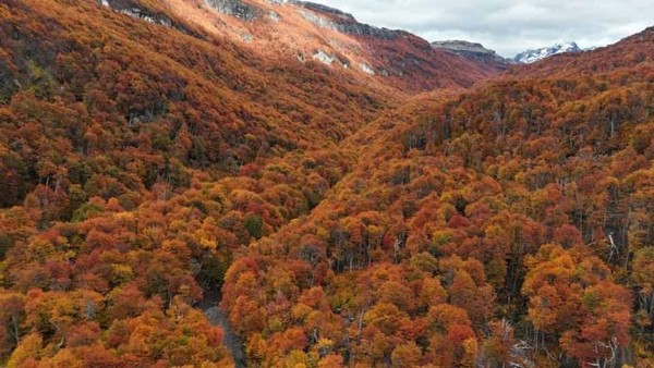
Nearly 50% of the Aysén Region's area is covered by forest ecosystem use. This is revealed by the update of the Vegetational Resources and Land Use Inventory of the Aysén Region.
According to CONAF's executive director, Aída Baldini, 48.7% of the regional area is covered by forest use. Of this percentage, 0.33% corresponds to forest plantations, 48.3% to Native Forest, and 0.02% to mixed forests.
She added that in the Aysén Region, it is noteworthy that the previous monitoring was published over 10 years ago, making it necessary and expected to obtain new cartography and areas associated with each land use, including the distribution of forests and their various forest types. Approximately 49% of the area is forest use, followed by grasslands and shrublands with 25% of the regional area, then land uses such as areas devoid of vegetation with 9.1%, and snow and glaciers with 11.2% of the regional area.
Forest Extent
Regarding the area covered by different land uses, the most extensive is Forest, with a total area of 5,189,923.7 hectares, highlighting Native Forest with 5,152,384.3 hectares, followed by forest plantation subuse with 35,473.6 hectares and mixed forest with 2,065.9 hectares. The next significant use is grasslands and shrublands, occupying 2,606,729.0 hectares, followed by areas devoid of vegetation with 1,141,667.8 hectares, where lands above the altitudinal vegetation limit stand out with 1,009,402.5 hectares, and then snow and glaciers with 1,114,497.1 hectares. Agricultural land covers over 37,000 hectares, wetlands exceed 106,000 hectares, and urban and industrial areas reach 6,468.7 hectares.
The vegetational resources inventory not only updates land uses but also provides knowledge of forest and vegetation areas in general, contributing information to define and manage regional ecosystem services, such as timber production, water production, soil protection, carbon capture, wildlife habitat provision, and recreational opportunities, thereby aiding climate change mitigation.
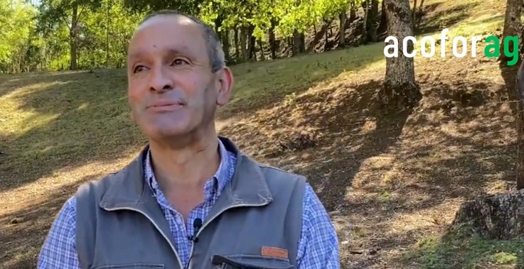
The presentation of the results in the region was led by CONAF's regional director, Ronald Valenzuela, and the head of the Monitoring Department of the Corporation's Inspection Management, Francoise Pincheira, who emphasized the importance of updated data for better forest management in the region.
In the Aysén Region, four forest types were identified, comprising the entire native forest area: Guaitecas Cypress, Lenga, Magellan's Coihue, and Evergreen. The dominant type is Evergreen, covering 2,552,613.1 hectares (49.5% of the regional native forest), followed by Lenga with 1,409,259.7 hectares (27.35%), Magellan's Coihue with 882,420.0 hectares (17.1%), and Guaitecas Cypress with 308,091.5 hectares (6%).
A large number of dominant species were identified in the region, totaling 306 species, of which 116 had not been previously detected. Additionally, species classified under conservation categories—Vulnerable, Endangered, and Critically Endangered—were detected, including: Asplenium trilobum; Austrocactus patagonicus; Maihueniopsis darwinii; Pterocactus australis; Pterocactus hickenii; Schinus marchandii.
Magellanic Tundras
The largest difference recorded between the 2010 and 2023 updates of the Vegetational Resources Inventory occurs in the Magellanic Tundras subuse, which was not represented in 2010 but now covers 13.9% of the region. Primarily, the current Magellanic Tundras use originates from 51.86% of what was classified as "Grasslands and Shrublands" in 2010, associated with subuses like Shrubland-Grassland, Shrubland, and Arborescent Shrubland.
There is also a positive difference of approximately 750,000 hectares between the Native Forest area recorded in 2010-2011 (41.2%) and 2023 (48.3%), explained by the higher level of adjustment in unit definition (0.5 ha) and digitization work supported by SENTINEL images and Google Earth. This also impacted Forest Types, particularly "Evergreen" and "Guaitecas Cypress," where positive differences resulted from manual photointerpretation corrections of vegetational units, aided by high-resolution images and field campaigns that improved dominant species identification.
Information related to the update of the Vegetational Resources and Land Use Inventory of the Aysén Region is available for access and download through the SIT CONAF platform at sit.conaf.cl.


Comentarios (0)
No hay comentarios aún. ¡Sé el primero en comentar!
Deja un comentario