
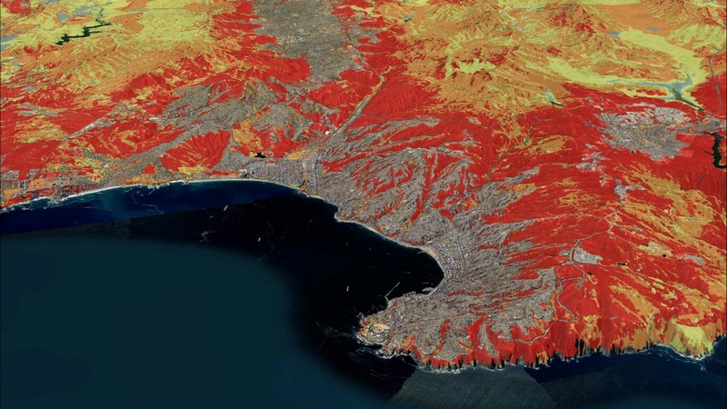
The Biobío Region concentrates the largest area under a very high wildfire threat category, according to results from the new Wildfire Risk Map, developed by the National Forestry Corporation (CONAF) and presented by authorities.
The tool aims to determine threat, vulnerability, and risk levels across the entire country, from Arica and Parinacota to Magallanes, with the goal of strengthening prevention and emergency response.
Biobío tops the ranking with 6.5% of its territory—equivalent to 156,270 hectares—under a very high threat condition, particularly in areas like Gran Concepción, Arauco, Lebu, and Curanilahue. It is followed by the Valparaíso (4.7%) and Metropolitan (4.5%) regions in this category.
The Minister of Agriculture, Esteban Valenzuela, stated that the map is a key tool to address the growing wildfire threat: "Half of the national territory has some level of risk, whether due to threat or vulnerability, as a result of our biodiversity, agricultural, and forest areas. This tool will help focus actions with better information."
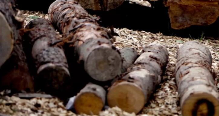
Over the past decade, the area affected by wildfires nationwide has increased by 194%, rising from an average of 55,378 hectares burned (2004-2014) to 162,675 hectares (2014-2024). Additionally, the largest fires—those exceeding 200 hectares—have increased by 88% in number and 185% in average damage.
From the Ministry of the Interior, Undersecretary Víctor Ramos emphasized that the map will be available to all municipalities in the country and will help better anticipate next-generation wildfires: "We know temperatures continue to rise. These kinds of tools help us coordinate public services and strengthen prevention."
CONAF's Executive Director, Aida Baldini, explained that the map is the result of a joint effort to understand fire behavior across the territory: "With this tool, available to all citizens, we significantly contribute to better preparation and response."
Meanwhile, Senapred's National Director, Alicia Cebrián, highlighted the map's usefulness not only for her agency but also for the entire disaster prevention and response system: "Decision-making requires updated, localized information. This map should be a key tool for territorial planning, both at municipal and regional levels."
The situation in Biobío underscores the urgency of implementing more robust prevention strategies, especially in areas with high vegetation, urban-rural interfaces, and forestry activity.


Comments (0)
No comments yet. Be the first to comment!
Leave a comment