
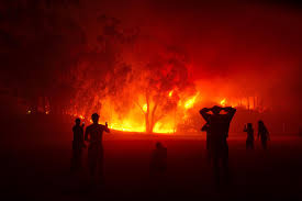
With over 508 homes destroyed, 7,045 people affected, and 19 fatalities in Biobío alone, the wildfires that struck the region over the weekend triggered a large-scale emergency. In this regard, professors from the University of Concepción agreed that this disaster reached an unprecedented magnitude in over a decade.
The Province of Concepción became one of the epicenters of the disaster. Areas such as Lirquén, Penco, Punta de Parra, Trinitarias, Rancho Chico, Palomares, and nearby rural areas faced extremely rapid spread, driven by adverse weather conditions and the high continuity of the forest landscape.
The extent and scope of the damage confirm various studies showing that the region faces structural conditions that exceed operational response capabilities. This situation, warn professors from the University, requires a deep review of land-use policies.
Wildfires: Conditions that accompanied the spread
Climatologist and Director of the Department of Geophysics at the Faculty of Physical and Mathematical Sciences, UdeC, Dr. Martín Jacques Coper, explained that during the most critical days, extreme temperatures were recorded in various points of the south-central part of the country. This scenario was accompanied by very low humidity and wind gusts along the coastal edge.
"While in Concepción the extreme values were approximately 26°C maximum and 38% relative humidity, in Chillán 37°C and 15% were recorded. On the Biobío coast, there are records of gusts of approximately 50 km/h. Together, this combination of conditions favors the rapid spread of fire," he stated.
Dr. Jacques dismissed the notion that these patterns were unexpected, as the conditions were properly forecasted. These fit within a scenario where the current summer had already presented repeated episodes of extreme heat.
"The two previous weekends we had heatwaves in sectors of the interior of the region. The extreme weather conditions this weekend were well forecasted. Furthermore, in line with the research we conduct at UdeC, in the case of these warm events, there are certain longer-term precursor signals that we have been able to monitor," he added.
Regarding comparison with events like those in 2017 or 2023, the professor stated that the regional risk remains persistently high. This is explained by factors not solely framed within meteorological analysis:
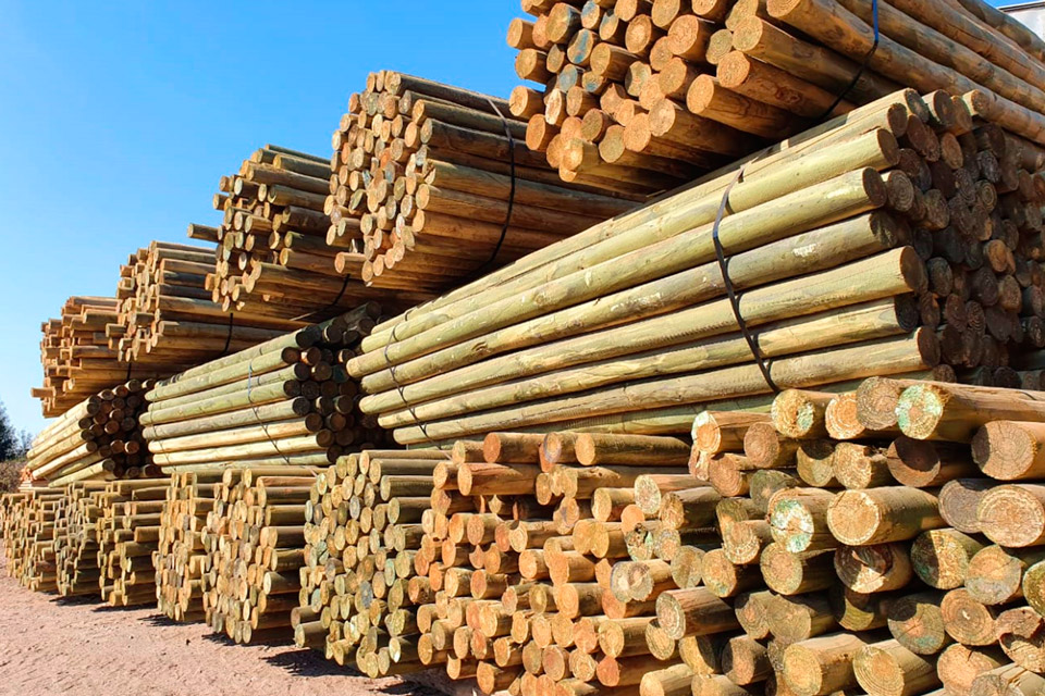
"The landscape is dominated by extensive, uniform, and continuous forest plantations, highly prone to fire spread. Additionally, superimposed on that, we have had precipitation deficits and warm events that dry out the fuel and facilitate fire spread once ignition sources exist."
Territorial risk, a foreseen and widely documented threat
The territorial analysis developed by the Societal and Natural Risk Reduction Laboratory (LARRS) of the EULA Center at the University of Concepción had already identified wildfires as the main threat to the Province of Concepción.
This occurred in the context of the study for the Objective Image of the Metropolitan Regulatory Plan of Concepción, funded by the National Fund for Regional Development (FNDR).
The Director of the Societal and Natural Risk Reduction Laboratory, Dr. Octavio Rojas Vilches, explained that this analysis determined that most of the provincial area faces wildfire threat, in terms of physical conditions favorable for their occurrence or spread.
"Nearly 90% of the provincial area is threatened to some relevant degree by wildfires. But the very high levels are especially concentrated in the urban-forest interface zones present in all communes," he said.
The urban-forest interface refers to areas where neighborhoods directly border homogeneous forest masses.
Within this same study, sectors such as Penco, Lirquén, Palomares, Florida, Hualqui, and Santa Juana were identified as vulnerable areas. Several of these territories exactly coincided with the most affected sectors in this emergency.
However, the designation of wildfire risk is a broader concept. It not only considers the threat, the fire's capacity to ignite and spread, but also exposure. That is, whether there are people, homes, or infrastructure in the affected area.
"Most human settlements and population are concentrated on the coast, while towards the interior, dispersed housing predominates. These have diverse construction materials and, in many cases, are very close to or embedded within a landscape highly susceptible to fire. As a result of the combination between threat and exposure, wildfire risk reaches 99% of the provincial area," he determined.
The researcher emphasized that wildfires have a higher recurrence than other risks with similar impact capacity.
"In terms of damage to people and homes, only tsunamis present comparable magnitudes; however, the fundamental difference lies in the recurrence, which is significantly lower for tsunamis compared to wildfires," he stated.
At the regional level, 84% of the metropolitan territory is exposed to one or more threats according to the analysis. This poses significant challenges for reconstruction and planning processes.
According to Dr. Octavio Rojas, the task will be to avoid repeating the ways in which land has been occupied.
"The reconstruction process following this emergency will have a central challenge: rethinking the ways of territorial occupation and urban development, so as not to reproduce the patterns that contributed to the materialization of this regrettable disaster."
The challenges for addressing territorial vulnerabilities
The academic from the Department of Geography at the Faculty of Architecture, Urbanism and Geography and Director of the Multihazard, Vulnerabilities and Climate Change Study Group (Multiamenazas Biobío), Dr. Edilia Jaque Castillo, emphasized that vulnerability is a central component for understanding the observed impact level, both in educational and urban terms.
"Educational vulnerability, the key knowledge that we are inhabiting a wildfire danger zone, is not concrete information internalized by the community. On the other hand, the other urban vulnerability has to do with the construction materials of homes, which can allow fire to consume them in a very short time," explained the academic.
This, coupled with road infrastructure that is poorly suited in terms of availability and width, strongly conditions the response to rapidly spreading fires.
Similarly, land-use patterns also generate extreme risk scenarios recurrently.
"In the case of practically all communes on the coastal edge and, particularly all communes in the metropolitan area of Concepción, mixed land uses coexist. That is, homogeneous forest plantations are in immediate proximity to inhabited areas, as is the case of Juan Riquelme, Palomares, or Agüita de la Perdiz," she exemplified.
The problem, lamented Dr. Edilia Jaque, is that this pattern implies that a large-scale fire can repeat cyclically.
"Just as Santa Juana has not burned this year, subsequent occupation with the same type of use, with the same plantations, returning to generate the same types of uses in those same places will allow this to repeat in a couple more years, when the plantations reach sufficient mass to spread a fire," she warned.
The researcher warned that Chile still lacks a regulatory definition for the urban-forest interface, despite the fact that nationally it is in these areas where the highest mortality and destruction in recent fires have been concentrated. She also recalled that the updating of communal risk studies only became mandatory from 2025, and called for avoiding a gap of several years for the entire region to have adequate analyses that include threat, vulnerability, and exposure.
"For all communes in the Biobío region to update their risk studies based on what the Ministry of Housing and Urbanism currently asks for, it will take five, ten, or twenty more years. We cannot let that happen," she asserted.
Therefore, she underscored the need for applied and sustained science, with permanent technical tools for municipalities and communities. This way, risk maps, which have proven accurate in anticipating affected zones, are not just diagnostics but decision-making instruments for territorial action.


Comments (0)
No comments yet. Be the first to comment!
Leave a comment