

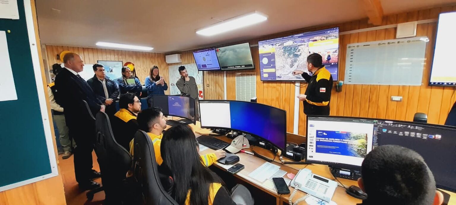
With an eye on the coming months and the need to stay ahead of forest fires, authorities in La Araucanía reviewed the progress of the Communal Plans for the Prevention and Mitigation of Forest Fires, along with the risk maps developed by the National Forestry Corporation (CONAF).
The available information covers all 32 communes in the region and incorporates territorial data on fire occurrence, affected area, main causes, and burn records. The goal is for this data to enable municipalities to identify the most vulnerable sectors and define in advance the measures that must be implemented.
Regarding communal planning, the documents have already been delivered in Los Sauces, Traiguén, and Victoria, while Lumaco is about to join the process.
The regional presidential delegate, Francisco Ljubetic, stated that having this information represents a starting point for municipalities to take an active role in prevention.
"Today, all 32 communes of La Araucanía have their fire risk maps, and we must work from there. It is imperative that each mayor carries out the tasks that correspond to them in their own communes," he said.
These tools make it possible to establish priorities in areas such as vegetation and fuel management, cleaning of critical sectors, intervention on roadside strips, preventive patrols, and regulation of fire use. They also include educational actions, work with communities, and specific measures for urban-rural interface sectors and critical infrastructure.
The Regional Government also anticipated follow-up on the actions carried out by municipalities and raised the need to advance communal ordinances that strengthen prevention and establish measures suited to the reality of each territory.
Prevention before the emergency
For CONAF, one of the main challenges is making the most of the months before the highest-risk period to implement the measures identified in the plans.
The regional director of the corporation, Héctor Tillería, pointed out that this is the time to move forward with preventive work and not wait for emergencies to begin.
"This is the time when we must work on forest fires, on prevention and mitigation measures, with firebreaks, with work in schools, health clinics, and critical infrastructure, to try to reach summer with the measures in place," he indicated.
The authority also warned that the expansion of land subdivisions has created new scenarios for the occurrence and spread of fire, especially in rural areas where there is a high concentration of homes.
"Today we are talking about rural fires, in which we have a high density of homes, mainly due to the effect of land subdivisions, and that makes fighting and controlling a forest fire much more difficult," explained Tillería.
In this context, prevention takes on special relevance, considering that a fire in areas with scattered homes can quickly become an emergency of greater complexity.
Coordination and territorial work
The regional director of SENAPRED, Ian Gorayeb, highlighted that preparation requires coordination among the various agencies involved before and during an emergency.
According to him, working groups are already being developed with municipalities, public services, and private organizations, with the aim of advancing preparedness actions, including drills.
The methodology of the communal plans includes four stages:diagnose, prioritize, coordinate, and execute. This seeks to ensure that information gathering does not remain solely as a diagnosis, but rather leads to a schedule of measures, responsible parties, and follow-up mechanisms.
The challenge for La Araucanía over the coming months will be, precisely, to turn risk maps and communal plans into visible interventions on the ground.
The task includes strengthening coordination among municipalities, CONAF, SENAPRED, firefighters, companies, farmers, and communities, especially in those sectors where vegetation, infrastructure, and homes converge.
The ultimate goal is to reduce the exposure and vulnerability of territories to forest fires and improve protection conditions for people, their homes, critical infrastructure, and the region's natural heritage.





Comments (0)
No comments yet. Be the first to comment!
Leave a comment